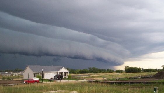
The powerful storm system that knocked out power to 26,000 Northern Kentucky customers on Aug. 11, may soon carry a rare meteorological label: derecho.
The Storm Prediction Center at 5:07 p.m. that day preliminarily confirmed that the mesoscale convective system that tore from eastern Iowa to northern Indiana qualifies as a derecho, a widespread straight-line windstorm. The center is now evaluating whether to extend that classification to include the storm's continuation into the Cincinnati and Northern Kentucky area, which would encompass Florence, Union, Burlington and Hebron.
The maximum measured gust was 99 mph at Gary, Indiana. Hurricane-force gusts over 90 mph were recorded in parts of Chicago, and Columbus, Ohio, saw gusts above 80 mph, according to CNN.
No specific wind measurements for Boone County have been released. But the National Weather Service issued multiple tornado warnings for the area Tuesday afternoon, tornado sirens sounded across the region, and residents reported funnel clouds. Travelers at Cincinnati/Northern Kentucky International Airport sheltered in place as the storms passed through.
What is a derecho?
The American Meteorological Society defines a derecho as a convectively induced straight-line windstorm. To qualify, the storm system must stretch more than 60 miles, last at least three hours, produce widespread wind damage or gusts of 58 mph or higher in a progressive sequence, and include at least five measured gusts of 75 mph or higher separated by 50 miles within a 250-mile wind swath, WLWT reported.
Derechos are uncommon in the Cincinnati area. The last notable one struck areas north of Cincinnati in 2012.
The SPC stated in its Aug. 11 bulletin that it is confident in the preliminary designation and expects the event to maintain the objective criteria once final storm data is released. Official 2026 derecho confirmations will not come until 2027, after the full year's data is finalized.
Power outages and restoration
More than 180,000 Duke Energy customers lost power as the storms moved through Greater Cincinnati on Aug. 11. As of 10 p.m. that night, about 160,000 remained without service, including roughly 26,000 across Northern Kentucky's Boone, Kenton and Campbell counties, according to a Duke Energy press release.
Duke Energy storm director Andy Cassidy said the damage exceeded expectations: "We've seen an even greater impact and significant damage than anticipated across the region, and another round of severe weather could create additional challenges."
Fallen trees, broken utility poles and damaged equipment are slowing restoration. Crews cannot perform elevated work in bucket trucks when winds reach 30 mph or higher, and some roads remain too hazardous for travel.
More storms possible
The flood threat is not over.
Northern Kentucky faces a Level 2 of 4 flood risk on Aug. 12, with saturated ground raising the chance that new downpours overwhelm roads and waterways. Additional severe weather could persist into Thursday.
Duke Energy urged customers to treat intersections with nonworking traffic signals as four-way stops and stay away from downed or sagging power lines. Outages can be reported by calling 800-543-5599 or texting "OUT" to 57801.